
Trace the Town of Colonie Street Directory
An address-first Town of Colonie record search works best as a trail. Begin with the property address exactly as it is known, then compare it against the parcel system before looking for people. The Town’s public GIS can show a mapped address, parcel keys, recorded deed-book references, owner fields, mailing fields, assessment values, and selected building details. That makes it the right first stop for a street-by-street search. The result is evidence tied to a parcel, not a household roster.
Keep a dated note for each result. Record the address spelling, Town or village layer, print key, SBL, roll year, and the source URL. Those details make it possible to revisit a result when a name, street label, or tax record changes.
- Normalize the house number, street name, suffix, postal city, and ZIP. Search the Town GIS address fields first, then copy the print key, SBL, deed book/page, owner field, and mailing fields shown.
- Check the same parcel in Image Mate or the annual assessment roll. The free public tier provides basic parcel and assessment access, while the County roll is a useful fallback if the portal is unavailable.
- Use the deed book/page or owner name in the County Clerk’s SearchIQS index. Match the property description and recording date before treating a recorded party as the same parcel.
- For a named person with the required identity details, use the state voter lookup only as a narrow confirmation. It is not a browseable list of everyone on a road.
- For older occupants, ask library or Hall staff about a street guide, reverse directory, or criss-cross volume for the relevant year. Those sources may show an address listing that a current parcel record cannot.
Normalize a Town of Colonie Street Address
Colonie address research is municipal, not just postal. The Town contains Village of Colonie and Village of Menands parcel layers, while delivery labels may say Latham, Loudonville, Cohoes, Watervliet, Albany, or Schenectady. A situs address is the mapped property address. A tax mailing address is where correspondence is sent. A deed’s legal description is the land description recorded with the Clerk. None of the four is interchangeable.
Start with the spelling printed on the document in hand. Then retain the return from USPS ZIP Lookup alongside the mapped address rather than changing one label to fit another. If a road crosses a village layer, query each applicable layer. A postal Albany label does not, by itself, establish Albany City jurisdiction.
Read Town of Colonie Street GIS Records
The public Town of Colonie parcel MapServer has separate Town, Village of Colonie, and Village of Menands layers. The Town layer supports map, identify, query, find, export, and spatial filtering. Its query limit is 2,000 records, so an address search should stay narrow. Use an exact address or parcel identifier rather than trying to export a whole-town list.
The GIS record can carry both address and history clues. Useful fields include PROP_ADDR or GISAddress, PRINT_KEY, SBL, DEED_BOOK, DEED_PAGE, ROLL_YEAR, OWNER1, and the mailing-address fields. Sale date, sale price, acreage, school, neighborhood, zoning, and building fields can provide context where populated. The Village layer has fewer fields, so a sparse record may reflect the layer’s design rather than a missing person.
| GIS field or tool | Street-directory use | Careful reading |
|---|---|---|
PROP_ADDR / GISAddress | Locate the mapped parcel by address | A situs field, not an occupant list |
PRINT_KEY / SBL | Carry a parcel identifier into rolls and deeds | Copy punctuation exactly |
OWNER1 and mail fields | Identify the assessment-record owner and tax mailing route | Mailing location can differ from the parcel |
DEED_BOOK / DEED_PAGE | Start a Clerk index search | Confirm description and dates in the document |
| Find, identify, query, spatial filter | Browse nearby mapped parcels by street | Use the correct Town or village layer |
Town of Colonie Records by Street
Several official sources are keyed to an address or parcel, but each answers a different question. The assessor and GIS layers show the present tax and mapping record. The Clerk’s land index connects parties to recorded documents. The Town tax screen finds a bill by address or map number. Building records may help date physical work, but no verified public permit index was located. Voter information is an individual identity-and-district search, not a street roster.
| Address-keyed source | Custodian | What it can show | Access path |
|---|---|---|---|
| Assessment card and roll | Town Assessor / County RPTSA | Assessed owner, parcel, values, tax mailing field | Image Mate, annual PDFs, or assessor contact |
| GIS parcel layer | Town MIS/GIS | Parcel polygon, SBL, print key, owner/mail fields, sale and building attributes | Free map and REST service |
| Recorded deed index | Albany County Clerk | Grantor, grantee, date, book/page, instrument, legal description | SearchIQS for listed 1980-present groups; Hall for earlier work |
| Tax bill | Town Tax Office | Bill, tax-map, or property-address result | Online, counter, mail; back-tax questions go to County Finance |
| Building or code file | Town Building / Planning | Work, applicant, permit, inspection, or certificate clues | Office request or FOIL; public index not verified |
| Historic directory | APL, NYSL, Hall, or Sanford | Year-specific address and occupant clues | Physical volumes, microfilm, staff, or licensed databases |
The Albany County assessment-roll postings provide a public-PDF route when an online property screen is blocked. For a detailed historic directory trail, the verified collection channels are summarized on the Town of Colonie city directory page.
Follow Town of Colonie Deed Records
The Albany County SearchIQS index is the online starting point for principal deed and mortgage groups from 1980 forward. Search a party name last name first, then narrow with date range, document group or description, Town when indexed, book/page, instrument number, or case number. Town indexing is not complete for every document, so a blank Town filter should not end the search. The County Clerk warns that an online result is not a complete title search.
For a parcel-based record trail, use the parcel record to test the match. The current owner may appear as grantee on a purchase deed, and the seller may appear as grantor. Match the legal description, acreage, road reference, book/page, and recording date. Before 1980, shift to the Hall of Records grantor/grantee index and deed volumes rather than assuming the online boundary means the parcel history begins there.
- Parcel
- A mapped tax unit, identified locally with a print key or SBL, that can be more stable than a street spelling.
- Situs address
- The physical property address shown in the mapping or assessment record, distinct from tax mail and postal formatting.
- Plat
- A recorded subdivision or survey map. A lot number or plat reference can connect an older deed to a current parcel.
- Criss-cross directory
- An address-first directory arrangement. Its availability must be checked for the particular year and locality.
Town of Colonie Street Tax Search
The Town tax-bill search accepts Bill Number, Tax Map Number, or Property Address. Use one field at a time. The published tips say to leave off leading zeros and post-dash digits in a bill number, to use a tax-map pattern such as 99.-9-99, and to enter an address with its house number and street but without a road or lane suffix. The tax screen is not a ZIP search and does not establish who occupies the address.
The Town’s Chapter 147 records-access rules are the route for a targeted request when an address-specific Building Department record or another Town record is not online. Name the address, parcel key, date range, and requested record class. The research did not locate a confirmed public permit index, retention schedule, or permit-copy fee, so those details should be confirmed with the office rather than guessed.
The Town records-access page shows the public-request route.
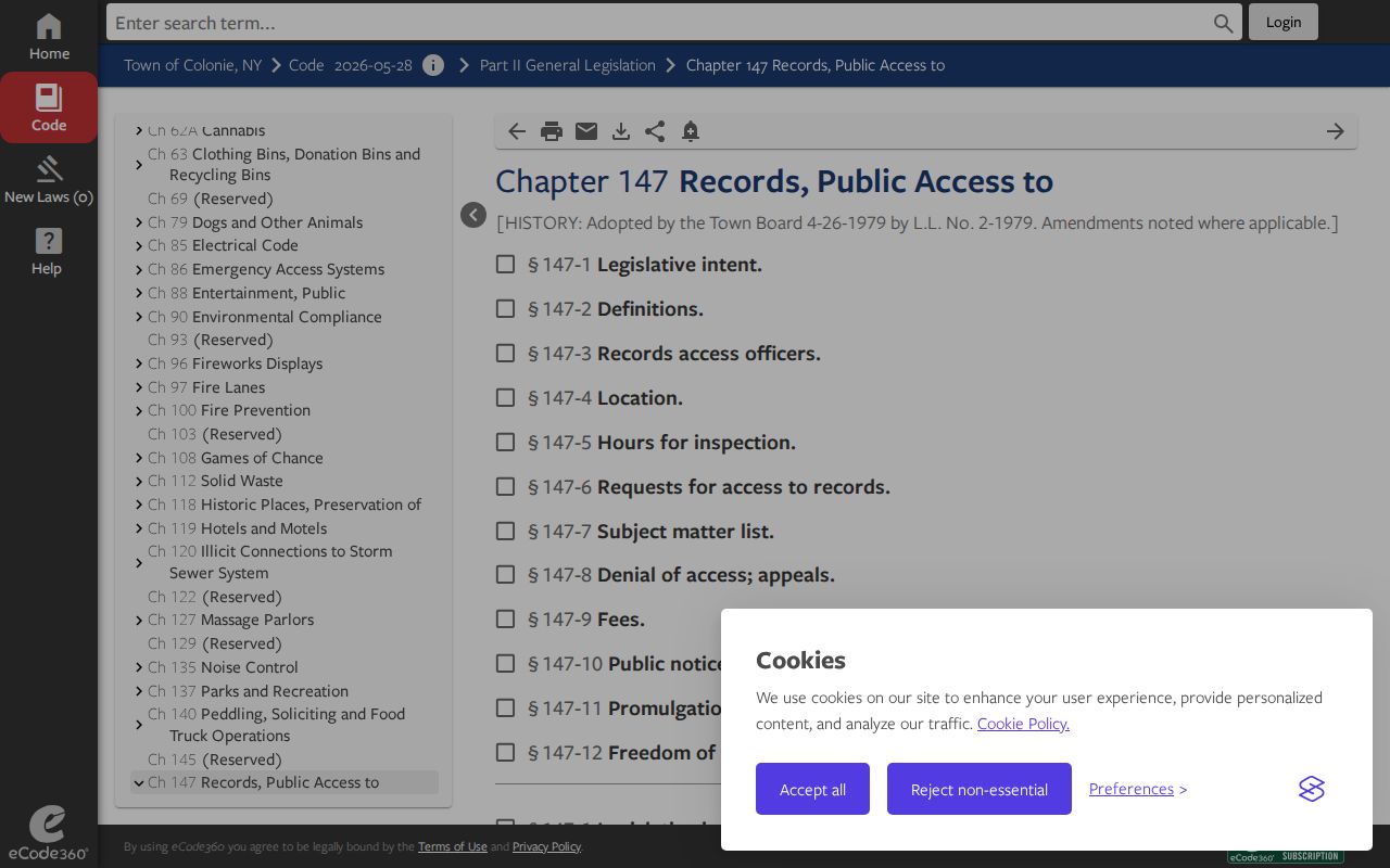
A focused request can preserve the address context that a broad address search would lose.
The Town tax search is a separate address-keyed entry point for bill and map-number work.
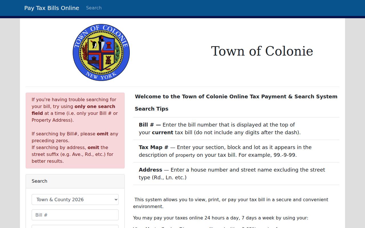
Pair a tax result with the parcel key and deed reference before drawing conclusions about a property’s record trail.
Note: The Town Tax Office is at Memorial Town Hall, 534 New Loudon Road, and Albany County Finance handles back-tax questions.
Situs and Mailing Addresses in Colonie
An address record should label the source field instead of collapsing all addresses into one claim. In the Town GIS, PROP_ADDR and GISAddress locate the property. MAIL_1ADDR, MAIL_CITY, MAIL_STATE, and MAIL_ZIP describe the tax correspondence destination. An owner can use an agent, business office, or other mailing location. The public record therefore supports “owner of record” or “tax mailing address,” not an unsupported statement that someone lives there.
The difference is visible in the research’s public examples: a residential parcel row can align property and mailing fields, while a Village commercial row can list an LLC with a distant mailing address. That contrast is why an address result needs its record date, parcel identifier, and layer noted beside it. It also avoids mistaking a commercial property record for a list of people at the site.
Colonie Street Postal Labels
Postal labels add another check to Town of Colonie address research. The official county ZIP material associates the area with 12047, 12110, 12128, 12189, 12204, 12205, 12211, and 12309, but each ZIP can cross a municipal line. Retain the USPS standardized city and ZIP exactly, then compare it with the Town GIS layer and parcel record. A mailing label from a nearby city or hamlet does not rewrite the parcel’s legal municipality.
For an older road, preserve alternate place names and the recorded legal description. Street addresses can be abbreviated, labels can change, and a road can meet a village boundary. The research found no documented Colonie-wide renumbering year or single renaming register. That gap is a reason to compare the SBL, print key, adjacent parcels, and deed description rather than relying on a street name alone.
Colonie Street Voter Check
New York’s voter lookup is useful only after a person is already identified. It asks for last name, first name, date of birth, county, address information, and ZIP. For a Colonie address, select Albany County. The form leads to registration, poll-site, and mail-ballot tasks. The unattended research did not capture a result display, so no unseen result fields should be promised.
Election Law sections 3-103(5) and 3-220 restrict voter information and its non-election use. The State route is not a street browser, and an Albany County Board of Elections file request needs the required elections-purpose statement. A non-match may reflect spelling, a changed address, inactive or cancelled status, a protected record, or no registration. It does not prove that a person never lived at the address.
Note: The county Board of Elections can handle record-correction, inspection, and protected-voter questions for local addresses.
Town of Colonie Street Directory Limits
Property and deed records are not a census of a street. They do not identify every non-owner occupant or ordinary household member. Utility and delivery records are not public address directories, and DMV information is protected. A historic directory can omit a person, use initials, reflect a prior address, or cover a different postal label. A voter result is regulated and narrowly tied to a matching individual.
Use address records for personal, lawful research such as family history, estate questions, source verification, and neighborhood or property curiosity. Keep the source date and custodian with each note. If a public field appears wrong, seek a correction from the custodian and preserve the record identifier. The New York Address Confidentiality Program and protected-voter rules also mean that a blank or limited result must never be reverse-engineered.
Lawful use. Town of Colonie street records are for responsible personal research. Do not use an address result to stalk, harass, intimidate, or harm anyone.